From the free course AP Human Geography on Lykke
7.2 Economic Sectors and Patterns
Key concepts: Primary, secondary, tertiary, quaternary, and quinary economic sectors · Development patterns associated with different economic sectors · Core, semiperiphery, and periphery locations · Manufacturing location factors · Labor as a determinant of industrial location · Transportation networks and shipping containers · Break-of-bulk points · Least-cost theory · Markets and resources as influences on manufacturing location · Growth poles and infrastructure’s effects on society
A smartphone connects several economic sectors before it reaches your hand: minerals are extracted, components are manufactured, software is designed, advertising and retail services sell it, and researchers or executives coordinate innovation and strategy.
7.2 Economic Sectors and Patterns
A smartphone connects several economic sectors before it reaches your hand: minerals are extracted, components are manufactured, software is designed, advertising and retail services sell it, and researchers or executives coordinate innovation and strategy. Economic sectors classify these activities by the kind of work they perform, while economic geography asks where those activities cluster and why.
Learning Objective SPS-7.B: Explain how economic sectors are spatially distributed and how changes in economic sectors affect development.
The five economic sectors
The sectors form a useful chain, although real economies often combine them:
| Sector | Main activity | Illustrative example |
|---|---|---|
| Primary | Extracting or harvesting natural resources | Mining copper, fishing, farming timber |
| Secondary | Processing raw materials and manufacturing goods | Producing steel, cars, or microchips |
| Tertiary | Providing services to people and businesses | Retail, transportation, banking, education |
| Quaternary | Producing and managing information, knowledge, and technology | Software development, research, data analysis |
| Quinary | High-level decision-making and specialized leadership | Government leadership, corporate executives, advanced policy planning |
A country’s sectoral composition—the relative importance of its sectors—often changes with development. Primary activities may dominate where economies depend heavily on resource extraction; secondary manufacturing commonly expands during industrialization; and tertiary, quaternary, and quinary activities become increasingly important in highly developed economies.
Spatial patterns: core, semiperiphery, and periphery
The core-periphery model describes an uneven global economic pattern. Core locations generally concentrate advanced services, research, corporate headquarters, capital, and high-value decision-making. Periphery locations often supply raw materials or lower-cost labor, while semiperiphery locations occupy an intermediate position: they may manufacture goods for global markets while also developing specialized services and technology.
These categories describe relationships, not permanent rankings. A region can be peripheral in one activity and core in another. For example, a place may export agricultural commodities but operate as a regional core for banking, transportation, or higher education.
Growth pole: A concentration of economic activity that stimulates growth in surrounding areas.
A growth pole may be a research university, technology district, hospital, government-sponsored zone, or cluster of new businesses. It attracts investment, specialized labor, suppliers, and infrastructure; these connections can spread employment and economic activity into nearby communities. The effects are not automatically equal, however: growth may also increase land prices, traffic, inequality, pollution, and pressure on water or energy supplies.
Why manufacturing locates where it does
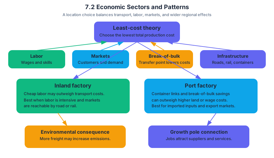
Manufacturing location reflects a search for the lowest combined production cost. Least-cost theory predicts that an industry tends to locate where transportation, labor, land, energy, materials, and other costs together are minimized—not necessarily where any single cost is lowest.
$$ \text{Total production cost}
\text{transportation cost} + \text{labor cost} + \text{land, energy, and resource costs} $$
Manufacturers compare several forces:
- Resources: Resource-oriented industries, such as paper mills or metal processing, may locate near bulky or heavy raw materials.
- Labor: Labor-intensive industries may seek abundant, affordable workers; high-technology industries often seek highly educated or specialized labor instead.
- Markets: Producers of perishable, fragile, or expensive-to-ship goods may locate near consumers.
- Transportation: Ports, railways, roads, warehouses, and logistics networks reduce the time and cost of moving inputs and finished products.
A break-of-bulk point is a location where goods are transferred between transportation modes. A seaport is a classic example: cargo may move from an ocean vessel to rail, trucks, or barges. Because transferring cargo costs time and money, warehouses, processing plants, distribution centers, and manufacturing may cluster near these points.
Shipping containers and the changing map of industry
Standardized shipping containers allow cargo to move efficiently between ships, trains, and trucks without unloading each item separately. Containerization lowers handling costs, reduces damage, and strengthens long-distance supply chains. As ports expand and connect to roads, railways, warehouses, and inland distribution hubs, manufacturing can locate farther from both raw materials and final markets while remaining connected to global networks.
Improved infrastructure can therefore increase economic activity and access. It can also produce costs: expanded ports and factories may increase pollution, resource consumption, congestion, habitat loss, and vulnerability to supply-chain disruptions. A port that creates jobs may simultaneously intensify air pollution or depend on energy-intensive transport.
Development does not erase older sectors
A national economy can shift from manufacturing toward services and technology while particular regions retain longstanding productive sectors. A rural area may continue farming, a mining district may remain resource-based, or a manufacturing city may preserve specialized factories even after national employment moves toward tertiary and quaternary work.
Misconception check: A country becoming more developed does not mean that its primary or secondary sectors disappear. Their relative share may decline, while their productivity, technology, or regional importance remains substantial.
Retrieval check
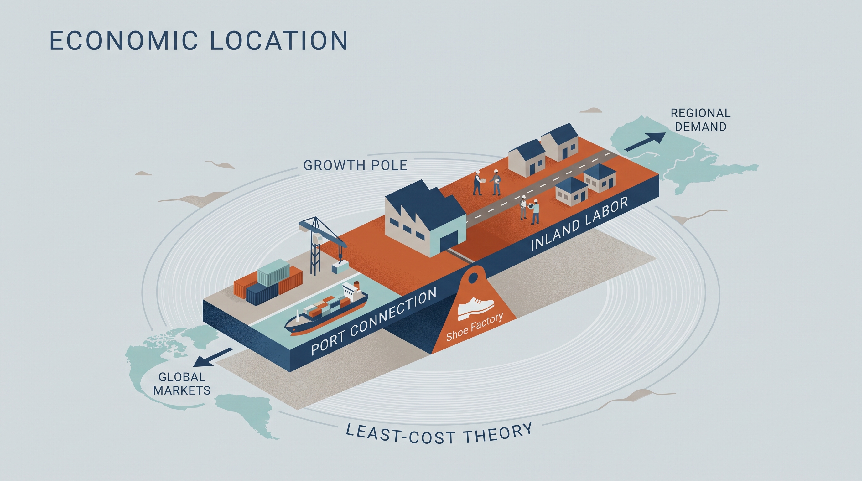
A shoe factory is choosing between an inland location with cheap labor and a port location with excellent container connections. Explain how least-cost theory, the break-of-bulk point, labor, markets, and infrastructure could produce either decision. Then identify one possible environmental consequence and explain how the factory might function as—or connect to—a growth pole.
Source Materials
- AP Human Geography Course and Exam Description
- AP Human Geography Course and Exam Description Clarifications and Corrections
- AP Human Geography Course Overview
- AP Human Geography Course at a Glance
- AP Human Geography Course at a Glance Poster
- AP Human Geography
- AP Human Geography
- AP Human Geography Sample Syllabus 1