From the free course AP Human Geography on Lykke
4.6 Internal Boundaries
Key concepts: Internal boundaries · Sovereignty · Government control · Subnational regions · Limits between subnational regions · Different types of subnational regions
Internal boundaries divide territory within a sovereign state, determining which subnational government controls a particular place. A single landscape may therefore be governed simultaneously by a national government, a province, a voting district, a school district, and a water district—each with its own boundary…
4.6 Internal Boundaries
Internal boundaries divide territory within a sovereign state, determining which subnational government controls a particular place. A single landscape may therefore be governed simultaneously by a national government, a province, a voting district, a school district, and a water district—each with its own boundary and responsibility.
Essential definition: Internal boundaries define the limits of sovereignty or government control between one subnational region and another.
From one sovereign state to many subnational regions
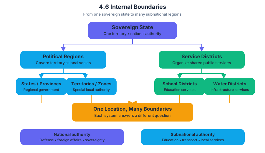
Sovereignty is a government’s authority to control territory and make decisions within it. Internal boundaries do not usually separate independent countries; instead, they divide the territory of one country into smaller administrative or political units.
A national government may establish states, provinces, territories, special administrative regions, autonomous zones, or voting districts. Local boundaries can also organize public services through school districts, water districts, and other infrastructure zones. The same location can belong to several of these systems at once because each boundary answers a different administrative question.
The key distinction is between the overall sovereignty of the state and the limited authority assigned to subnational regions. A province may control education or transportation, while the national government retains authority over national defense and foreign affairs. Internal boundaries identify where one subnational government’s authority ends and another’s begins.
CED traceability: Topic 4.6 Internal Boundaries; Learning Objective 4.6; Essential Knowledge 4.6.A and 4.6.B. The topic’s central reasoning is that internal boundaries can delimit or unify different types of subnational regions.
Boundaries can separate—and organize—different regions
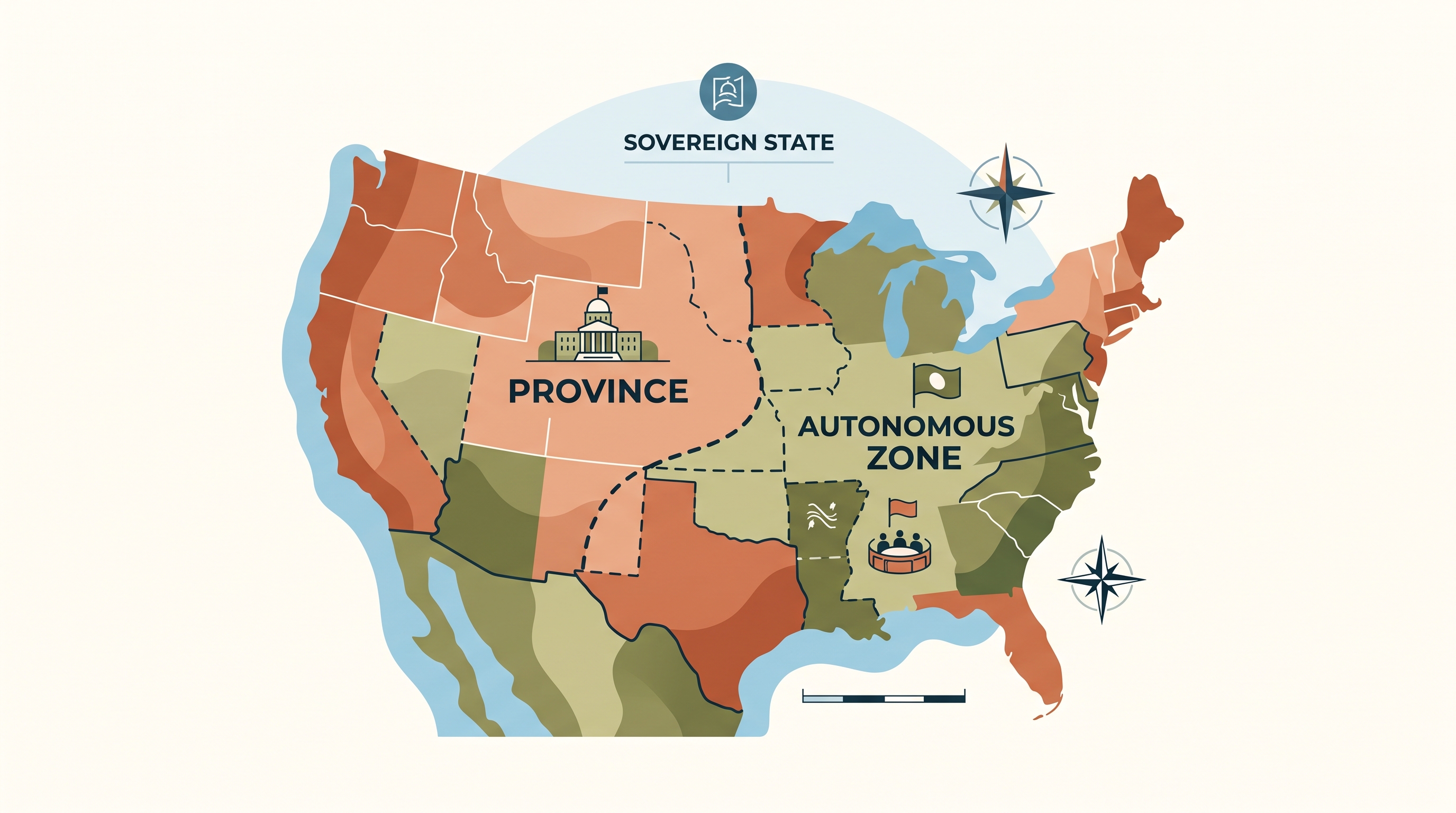
Internal boundaries may separate distinct types of subnational regions. For example, a national territory might contain provinces, autonomous zones, and special administrative regions whose legal powers differ. A boundary marks the transition from one set of governing rules or administrative responsibilities to another.
They can also unify different types of subnational regions within one national political system. A province, a voting district, and a school district may have different purposes, but their boundaries collectively organize the same population and territory under the authority of one state.
Internal boundaries can also unify or separate ethnic, cultural, or national groups. A boundary might place a culturally similar population within one administrative unit, helping preserve an identity, or it might divide that population among several units. Consequently, boundaries may reduce conflict by recognizing differences—or intensify conflict when groups view the divisions as unfair.
Worked example: assigning authority in a growing region
Imagine a country creates a new coastal province. The national government assigns the province responsibility for regional roads and hospitals. Within the province, officials draw voting districts and school districts; a separate water district crosses several school-district boundaries because the same reservoir supplies multiple communities.
The reasoning is:
- The national–provincial boundary establishes the province’s area of government control.
- Voting-district boundaries organize political representation.
- School-district boundaries organize education services.
- The water-district boundary coordinates shared infrastructure across other boundaries.
- The boundaries may unify residents for administration while separating them for elections, schooling, or resource management.
This example shows why internal boundaries are not simply lines on a map. They allocate authority, divide responsibility, shape representation, and influence how governments collect and analyze data. A statistic reported by province may conceal important differences between school districts or ethnic communities inside that province.
Skill focus: scale and spatial relationships
Topic 4.6 is especially suited to Skill Category 2: Spatial Relationships, including 2.A Describe spatial patterns and 2.B Explain spatial relationships. On an exam, identify which regions touch, overlap, or are nested inside one another, then explain how that arrangement affects governance or public services.
It also develops Skill Category 5: Scale Analysis, especially 5.A Identify scales of analysis and 5.B Explain scales of analysis. A national map may show one province as a single unit, while a local map reveals several school, voting, or water districts within it. The pattern—and the explanation—can change with scale.
Misconception check
Misconception: every boundary represents a separate sovereign country. Correction: an internal boundary usually lies within a sovereign state and separates subnational regions. A state or province may possess meaningful governmental authority without being an independent state.
Retrieval check: A boundary separates a province from an autonomous zone inside the same country. Is it an international boundary or an internal boundary? What does it identify? Answer: It is an internal boundary; it identifies the limits between two subnational regions with potentially different governmental powers.
Source Materials
- AP Human Geography Course and Exam Description
- AP Human Geography Course and Exam Description Clarifications and Corrections
- AP Human Geography Course Overview
- AP Human Geography Course at a Glance
- AP Human Geography Course at a Glance Poster
- AP Human Geography
- AP Human Geography
- AP Human Geography Sample Syllabus 1