From the free course AP Human Geography on Lykke
4.5 The Function of Political Boundaries
Key concepts: Political boundaries · Cultural, national, and economic divisions · Demilitarized zones · Berlin Conference · Land and maritime boundaries · International agreements · National and regional identity · International and internal interactions · Territorial seas · Exclusive economic zones
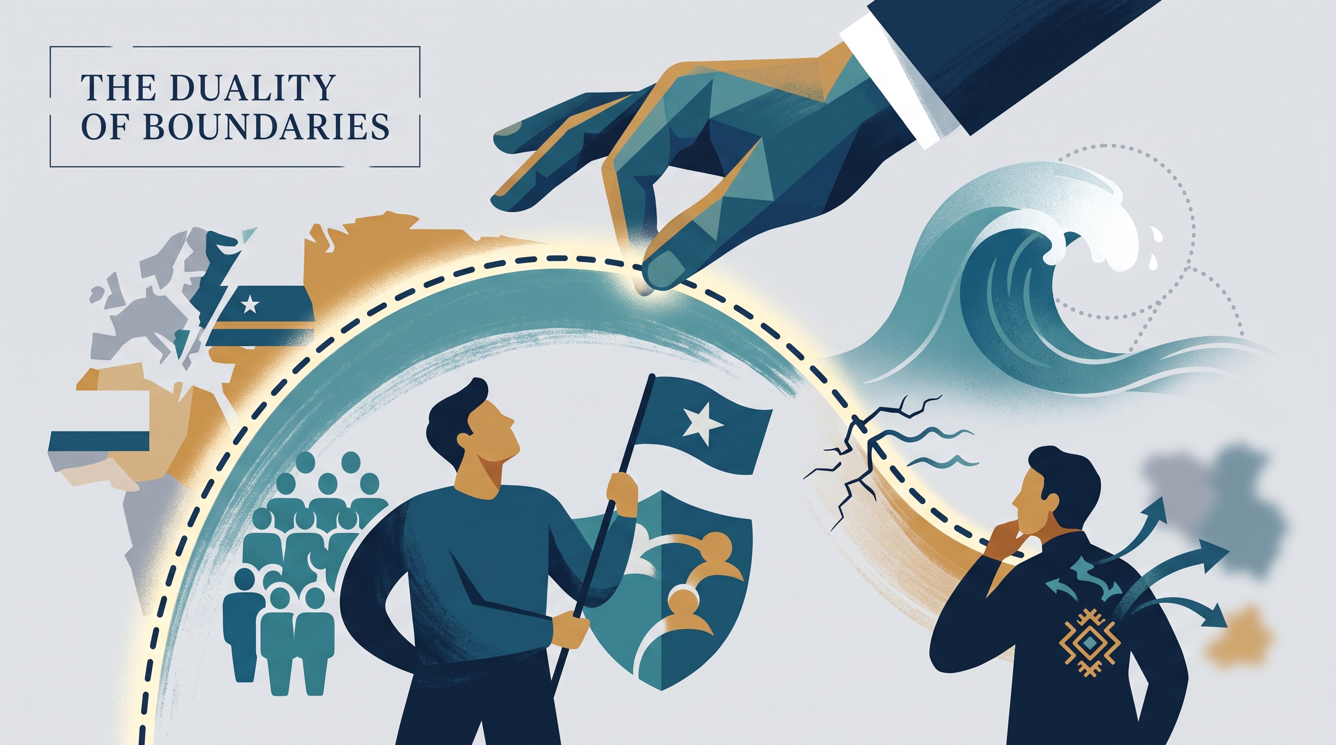
Political boundaries organize who governs a place, who may cross it, which resources a state may use, and how people imagine collective identity. A line on a map can therefore act simultaneously as a legal limit, a cultural symbol, an economic filter, and a source of conflict.
4.5 The Function of Political Boundaries
Political boundaries organize who governs a place, who may cross it, which resources a state may use, and how people imagine collective identity. A line on a map can therefore act simultaneously as a legal limit, a cultural symbol, an economic filter, and a source of conflict.
Enduring Understanding IMP-4: Political boundaries and divisions of governance, between states and within them, reflect balances of power that have been negotiated or imposed.
The central question is not merely where a boundary lies, but what the boundary does. Through administration—such as border enforcement, regulation, and resource management—a boundary turns an abstract territorial claim into an operating system for sovereignty.
Boundaries as divisions—and as connections
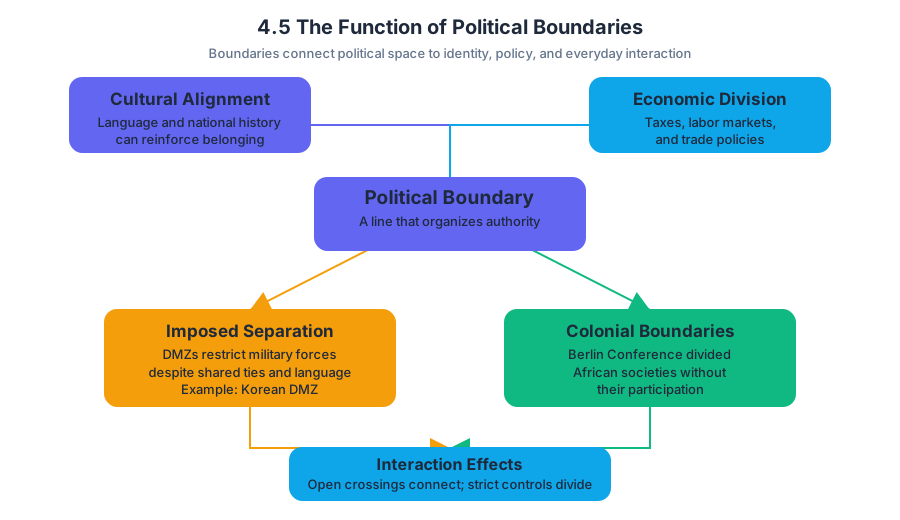
Under Learning Objective IMP-4.B, political boundaries may coincide with existing cultural, national, or economic divisions. A boundary separating states with different languages or national histories can reinforce a sense of belonging. A boundary aligned with an economic region may separate different tax systems, labor markets, or trade policies.
Yet boundaries do not always follow the distribution of people or culture. Some are imposed through policy or created through separation arrangements. A demilitarized zone, or area where military forces are restricted or prohibited, can function as a political separation even when the people on either side share language, history, or family ties. The Korean Demilitarized Zone illustrates how a policy-created division can sharply discourage interaction.
The Berlin Conference demonstrates another imposed pattern. European powers negotiated rules for claiming African territory without the participation of the African societies being divided. The resulting colonial boundaries often grouped different peoples within one political territory or separated communities across multiple territories. After independence, many of these boundaries remained, linking political borders to long-term identity debates and separatist movements.
A boundary can also encourage interaction. An international agreement may create a predictable crossing point, reduce tariffs, or clarify which government regulates a road, river, or port. Conversely, strict enforcement, militarization, or conflicting legal systems can discourage trade, migration, family visits, and regional cooperation.
Land and maritime boundaries
Land boundaries influence identity because they distinguish one state’s laws, symbols, citizenship, and political authority from another’s. They also affect practical interactions: a mountain border may limit movement, while a heavily monitored urban crossing may interrupt an otherwise continuous settlement pattern.
Maritime boundaries extend political authority into the sea. Under IMP-4.B.4, the United Nations Convention on the Law of the Sea establishes rights and responsibilities for nations using international waters and defines maritime areas under national jurisdiction, including territorial seas and exclusive economic zones.
| Maritime area | Political function |
|---|---|
| Territorial sea | Establishes a zone of national jurisdiction adjacent to a state’s coast. |
| Exclusive economic zone | Gives a state special rights to explore, use, and manage marine resources in the designated area. |
| International waters | Remain outside the direct jurisdiction of a single coastal state and are governed through international rules and agreements. |
These zones matter because valuable resources—such as fish, offshore energy, and seabed minerals—do not stop neatly at visible lines. Two states may therefore dispute where a maritime boundary should be placed or which state has the right to exploit a resource. An international agreement can settle, modify, or temporarily manage such a dispute, but agreement itself reflects bargaining power and competing interests.
Worked example: when a boundary changes behavior
Imagine two coastal states facing a declining fish population near their shared maritime boundary. Before an agreement, both fleets fish aggressively because each government fears that restraint will allow the other state to capture the resource. The boundary therefore discourages cooperation and encourages competition.
If the states negotiate an agreement that identifies each country’s maritime jurisdiction, sets seasonal limits, and creates a shared monitoring system, the same boundary begins to encourage interaction. At the international scale, it clarifies state rights; at the regional scale, it changes fishing patterns and port activity; at the local scale, it affects fishermen’s incomes and food supplies. This is 5.D Scale Analysis: explaining how the effects of a geographic concept vary across scales.
Identity, sovereignty, and challenges
Under IMP-4.B.3, land and maritime boundaries and international agreements can influence national or regional identity. A government may use a boundary to promote unity by emphasizing a shared territory, while residents near a border may develop a regional identity based on cross-border language, trade, or family networks.
Boundaries can also be challenged from within. Separatist movements seek greater autonomy or a separate state for a particular region or group. Independence movements go further by seeking sovereign statehood. If such movements succeed—or if governments respond by granting autonomy, redrawing internal divisions, or recognizing a new state—established political boundaries may change and state sovereignty may be weakened or reorganized.
Named misconception: A boundary does not automatically create cultural unity on one side or cultural difference on the other. It may reflect an existing division, but it may also be imposed, contested, and crossed every day.
Retrieval check: A maritime agreement creates an exclusive economic zone, reduces naval tension, and assigns fishing rights. Identify one effect at the international scale and one effect at the local scale. Then explain whether the boundary is encouraging or discouraging interaction, and why.
Source Materials
- AP Human Geography Course and Exam Description
- AP Human Geography Course and Exam Description Clarifications and Corrections
- AP Human Geography Course Overview
- AP Human Geography Course at a Glance
- AP Human Geography Course at a Glance Poster
- AP Human Geography
- AP Human Geography
- AP Human Geography Sample Syllabus 1