From the free course AP Human Geography on Lykke
3.6 Contemporary Causes of Diffusion
Key concepts: Contemporary causes of diffusion · Cultural landscapes · Asian ethnic-group neighborhoods · Toponyms and religious diffusion · Agricultural practices and environmental effects · Chemical inputs and pollution · Mechanized farming · Irrigation and water competition · Conflicts between farmers and nomadic herders · Spatial relationships and source analysis
Contemporary causes of diffusion are modern forces that move cultural traits, practices, ideas, and technologies across space. Communication technologies, migration, transportation, globalization, and economic connections can make cultural contact faster and more extensive—but diffusion does not produce identical…
3.6 Contemporary Causes of Diffusion
Contemporary causes of diffusion are modern forces that move cultural traits, practices, ideas, and technologies across space. Communication technologies, migration, transportation, globalization, and economic connections can make cultural contact faster and more extensive—but diffusion does not produce identical places everywhere.
Core idea: Contemporary diffusion changes cultural landscapes by increasing contact among people and places.
Reading a Cultural Landscape Through Diffusion
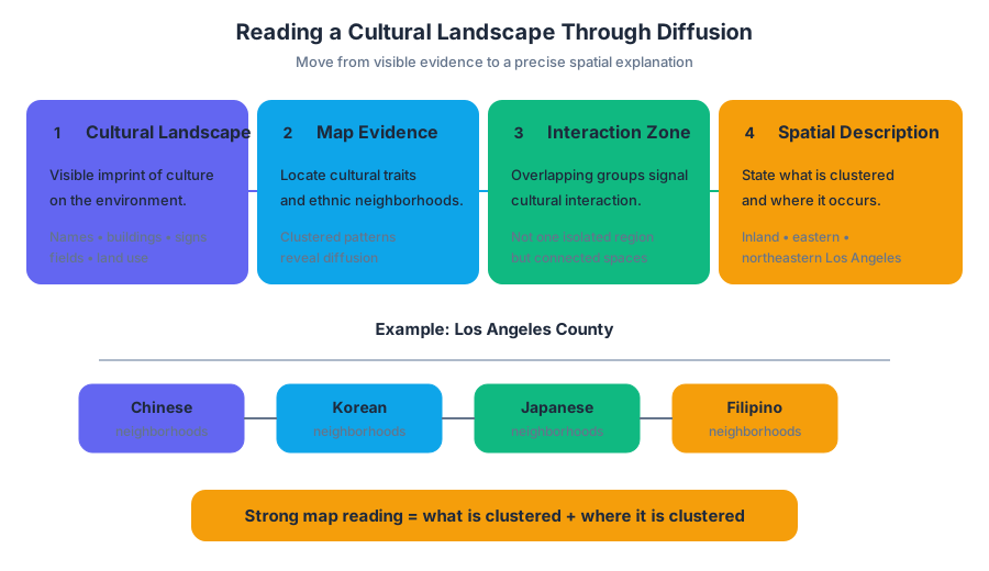
A cultural landscape is the visible imprint of culture on the environment. Neighborhood names, restaurants, religious buildings, languages on signs, agricultural fields, and patterns of land use can all reveal where cultural traits have diffused.
For example, a map of Los Angeles County may show neighborhoods associated with Chinese, Korean, Japanese, Filipino, or other Asian ethnic groups. If two or more ethnic-group neighborhoods overlap or occur near one another, the map shows a zone of cultural interaction rather than a single isolated cultural region.
When analyzing a map stimulus, do not stop at “the neighborhoods are clustered.” A complete spatial description identifies what is clustered and where it is clustered—for example, Chinese ethnic neighborhoods may be concentrated inland, away from the coast, or in the eastern and northeastern portions of Los Angeles County.
Worked map analysis
Suppose a map uses different colors for Asian ethnic-group neighborhoods. Three colors overlap in an inland portion of the county, while coastal areas show few or no marked neighborhoods.
Step 1 — Identify the pattern: The neighborhoods are clustered rather than randomly distributed.
Step 2 — Locate the pattern: The cluster is inland and toward the eastern or northeastern part of the county.
Step 3 — Interpret the pattern: The overlap indicates that multiple Asian ethnic groups reside in the same broad area, creating opportunities for cultural exchange, shared services, and the development of a multicultural landscape.
This reasoning demonstrates Skill 4.A: Source Analysis and applies PSO-3.C.1 from Topic 3.2, Cultural Landscapes, together with SPS-3.A.3 from Topic 3.6. The map is evidence; the answer must use its locations, not merely repeat a general geography term.
Misconception check — “Clustered” is enough: It is not. Without a directional or locational phrase tied to the map, “clustered” fails to describe the stimulus precisely.
Communication Technologies and Cultural Convergence
Modern communication technologies can accelerate diffusion by connecting people who are separated by great distances. Mobile phones, internet access, social media, and digital broadcasting can allow cultural information to circulate among groups that previously interacted less frequently.
This process may produce cultural convergence, meaning that different groups adopt increasingly similar cultural traits. However, the degree of convergence matters. Greater access to communication technology may create some convergence among nomadic herders by spreading music, clothing styles, language expressions, or consumer preferences, but it does not automatically erase local identity or make all groups culturally identical.
A strong explanation of degree uses a qualifier such as limited, moderate, or substantial, followed by evidence and reasoning:
Increased access to communication technologies may create moderate cultural convergence because nomadic herders can exchange media and consumer practices more easily, although distance, local traditions, and uneven access to technology can preserve cultural differences.
This applies SPS-3.A.4 and Skill 2.E: Scale Analysis when the response connects technology at the individual or community scale to broader cultural change.
Toponyms and Religious Diffusion
A toponym is a place name. Toponyms can preserve evidence of cultural diffusion because religious groups may name settlements, streets, rivers, or regions after sacred figures, religious events, or places associated with their faith.
The name becomes part of the cultural landscape even when the population later changes. Therefore, to identify the relationship, connect the chain explicitly:
$$ \text{religious diffusion} \rightarrow \text{settlement or cultural influence} \rightarrow \text{religious toponym} $$
Misconception check — “Toponym means religious place”: A toponym is any place name, not specifically a religious name. Religion is one possible cause of a toponym’s origin.
Agricultural Practices, Irrigation, and Environmental Effects
Contemporary diffusion also spreads agricultural practices and technologies. Irrigation, chemical inputs, and mechanized farming can raise production, but they may create environmental or social consequences.
Chemical inputs such as fertilizers and pesticides can increase pollution when runoff enters soil and waterways. Mechanized farming can produce negative environmental effects through soil compaction, habitat disruption, fuel use, or increased erosion. An AP explanation must connect the effect to the specific practice:
| Agricultural practice | Negative environmental effect | Causal connection |
|---|---|---|
| Chemical inputs | Increased pollution | Fertilizer or pesticide runoff contaminates soil and water |
| Mechanized farming | Soil degradation or habitat disruption | Heavy machinery compacts soil or clears larger areas rapidly |
| Increased irrigation | Water competition | More water is diverted to farms, reducing availability for other users |
This applies Skill 2.B: Spatial Relationships and IMP-5.A.1 and IMP-5.A.2 from Topic 5.10, Consequences of Agricultural Practices. Naming pollution alone is incomplete; the response must explain how chemical inputs caused it.
Irrigation and Conflict With Nomadic Herders
Increased irrigation can create competition for water between farmers and nomadic herders. Farmers may divert more water to crops, while nomadic herders depend on the same water sources for livestock and seasonal movement.
Consider this original chart:
| Area | Irrigated farmland | Water available for grazing routes | Reported tension |
|---|---|---|---|
| A | Low | High | Low |
| B | Moderate | Moderate | Moderate |
| C | High | Low | High |
The pattern supports a causal explanation: as irrigation increases, less water remains available for nomadic herders, increasing competition and potentially producing tension or conflict between the two groups. This uses Skill 4.F: Source Analysis, PSO-5.A.3, and IMP-5.A.2.
Exam-ready distinction: Farmers and nomadic herders are different groups with competing water needs. Do not treat them as interchangeable, and do not cite unrelated chart information as the cause of conflict.
Retrieval Check
A map shows several Asian ethnic-group neighborhoods clustered inland in the eastern portion of a county. A table shows that areas with increased irrigation have less water available for grazing and more conflict. Identify one spatial pattern and explain one causal relationship shown by the table.
A complete response would state that the neighborhoods are clustered inland and eastward, then explain that increased irrigation diverts water toward farms, intensifying competition with nomadic herders and increasing tension.

Source Materials
- AP Human Geography Course and Exam Description
- AP Human Geography Course and Exam Description Clarifications and Corrections
- AP Human Geography Course Overview
- AP Human Geography Course at a Glance
- AP Human Geography Course at a Glance Poster
- AP Human Geography
- AP Human Geography
- AP Human Geography Sample Syllabus 1