From the free course AP World History: Modern on Lykke
2.7 Comparison of Economic Exchange
Why did similar goods travel through very different systems? Between approximately $1200$ and $1450$, merchants connected Afro-Eurasia through the Silk Roads, Indian Ocean routes, and Trans-Saharan networks.
2.7 Comparison of Economic Exchange
Why did similar goods travel through very different systems? Between approximately $1200$ and $1450$, merchants connected Afro-Eurasia through the Silk Roads, Indian Ocean routes, and Trans-Saharan networks. Each system exchanged products, technologies, and ideas, but geography, transportation, political authority, and environmental conditions shaped how each worked.
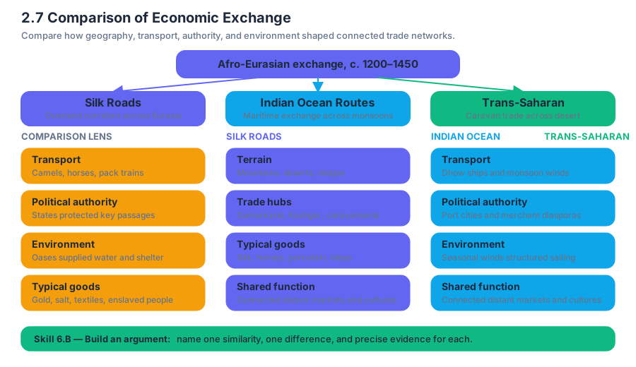
Topic 2.7 — Comparison of Economic Exchange asks students to compare these networks rather than memorize them as isolated routes. The central move is to identify a meaningful similarity, explain a meaningful difference, and support both with precise historical evidence. The topic is associated with Skill 6.B, which requires supporting an argument with specific and relevant evidence.
The comparison at a glance
| Exchange network | Geographic setting | Important goods | Main enabling conditions | Distinctive pattern |
|---|---|---|---|---|
| Silk Roads | Central and East Asia, the Middle East, and Europe | Silk, horses, porcelain, precious metals, textiles | Caravan travel, oasis cities, imperial protection | Long-distance overland exchange through relay points |
| Indian Ocean routes | East Africa, Arabia, South Asia, Southeast Asia, and China | Spices, cotton textiles, porcelain, ivory, gold | Monsoon winds, ports, ships, merchant communities | Maritime exchange organized around seasonal sailing |
| Trans-Saharan routes | North and West Africa across the Sahara | Gold, salt, enslaved people, textiles, books | Camel caravans, desert oases, Islamic commercial networks | Exchange between Mediterranean and sub-Saharan regions |
Similarity: networks depended on intermediaries
None of these systems was a single road controlled by one group. Goods usually moved through multiple merchants and markets. A Chinese producer might sell silk to a Central Asian trader, who transferred it to merchants connected to Persian or Mediterranean markets. Similarly, Indian Ocean cargoes passed through port cities where Arab, Persian, Indian, and Southeast Asian merchants exchanged goods without traveling the entire route.
This relay structure reduced risk and made exchange possible across enormous distances. Merchants relied on commercial infrastructure, meaning the institutions and facilities that support trade: caravanserais on overland routes, port cities and warehouses on maritime routes, and oasis settlements across the Sahara. Political stability also mattered because rulers could tax trade, protect merchants, and maintain roads or ports.
Difference: geography created different rhythms
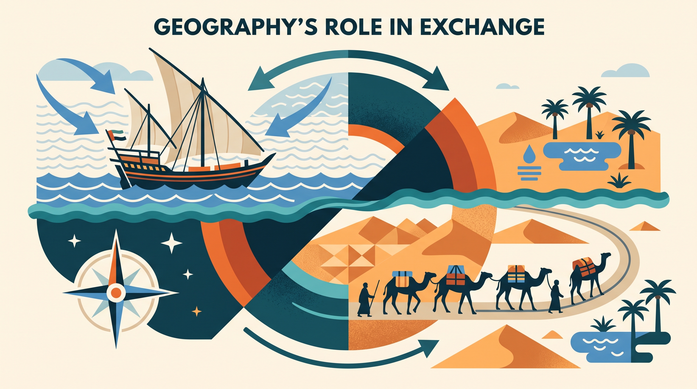
The Indian Ocean network depended especially on monsoon winds, seasonal wind patterns that reverse direction during the year. A sailor could use one wind pattern to travel toward India or East Africa and a later pattern to return. This encouraged merchants to remain in port cities for months, helping create cosmopolitan communities and cultural exchange.
The Silk Roads and Trans-Saharan routes faced different physical constraints. Silk Road merchants organized travel around mountain passes, steppe routes, and oasis cities, while Saharan traders depended on camel caravans capable of carrying supplies across arid terrain. Thus, all three networks connected distant regions, but maritime trade used seasonal wind knowledge whereas desert and overland trade depended more heavily on pack animals, water points, and caravan organization.
Worked comparison: using “Southernization”
Lynda Shaffer’s idea of “Southernization” provides a useful way to compare economic exchange. The argument traces how crops, technologies, and commercial practices developed in southern parts of Asia moved westward and northward through interconnected routes. A student can map the movement of food crops and then ask not merely where they traveled, but which network made movement possible.
Step 1 — Claim: Economic exchange from $1200$ to $1450 spread both goods and productive knowledge across Afro-Eurasia.
Step 2 — Silk Roads evidence: Overland routes connected China and Central Asia to the Middle East, enabling luxury goods and technologies to move through caravan cities.
Step 3 — Indian Ocean evidence: Maritime routes linked South and Southeast Asia with East Africa and Arabia, allowing crops and agricultural knowledge to move through port cities shaped by monsoon sailing.
Step 4 — Difference: The Silk Roads depended on land-based relay systems, while the Indian Ocean system depended on ships, port networks, and seasonal winds.
Step 5 — Historical significance: These differences explain why exchange was not uniform: the same broad process of connectivity produced distinct regional patterns of settlement, merchant organization, and cultural interaction.
Misconception check: “Trade routes moved only luxury goods”
Luxury goods such as silk and spices were important because their high value justified long-distance transportation, but exchange networks also moved ordinary or productive goods. Food crops, cotton textiles, religious writings, metals, salt, and enslaved people circulated through these systems. The Southernization example is especially useful because it emphasizes the movement of crops and agricultural practices, not simply elite consumption.
A second misconception is that trade automatically produced equal relationships. Exchange connected regions, but merchants, rulers, and laborers experienced it differently. States collected taxes, commercial cities prospered, and some populations faced coercion or enslavement. A strong comparison therefore considers both connection and unequal power.
Retrieval and interpretation check
A historian claims: “The three major exchange networks were similar because all relied on intermediaries, but they differed because geography determined their operating methods.”
Which evidence best supports the second part of the claim?
- A. Merchants often traded goods several times before they reached their final buyers.
- B. Indian Ocean sailors used seasonal monsoon winds, while Trans-Saharan merchants depended on camel caravans and oasis settlements.
- C. Luxury goods traveled across long distances in all three systems.
- D. Political rulers benefited from taxing commercial activity.
Answer: B. It identifies a specific geographic condition and connects that condition to a distinct method of exchange. That is the kind of precise comparison required by Skill 6.B.
Source Materials
- AP World History: Modern Course and Exam Description
- AP World History: Modern Course and Exam Description Clarifications and Corrections
- AP World History: Modern Course Overview
- AP World History: Modern Course at a Glance
- AP World History: Modern Course at a Glance Poster
- AP World History: Modern
- AP World History: Modern
- AP World History: Modern Sample Syllabus 1